interkriti®
YOUR GATEWAY TO CRETE
HOME
CRETE FACTS
NAVIGATE
EXPLORE

Agia Galini
Triopetra
Kissamos
Chryssi Isl.
Agia Marina
Balos
Gavdos isl.
Georgioupolis
SAMARIA
IDA Mtn
Palaiochora
Agia Roumeli
Sfakaki
Bali
Kalamaki
Matala
Lassithi
Plateau Lendas
Tsoutsouros
Vianos
Myrtos
Sfakia
Plakias
Ierapetra
Makrygialos
ZAKROS
Vai
Sitia
Agios Nikolaos
Elounda
MALIA
Hersonissos
Gouves
Chania
Rethymnon
Heraklion
GORTYN
FESTOS
KNOSSOS
|
|
Crete
List Grid Map
Found
59
- Showing :
21 - 40
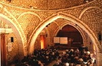 Rethymnon old town at 15.4km (NW) During Venetian occupation the mosque Neratzes, which today is used as a conservatory, was the Augustinian church of the Holy Virgin. In 1657 the Turks transformed it into the mosque 'Gazi Housein' or 'Neratze', and in 1890 they added a large minaret with two galleries, which was built from the famous stones from the village of Alfa. The chapel of the Holy Virgin, situated at its west side and dedicated to the Body of Christ, was also transformed into a seminary. Outstanding elements of this building are the doorframe and the three domes.
Image Library
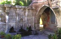 Rethymnon Old Town at 15.4km (NW) A. Rimondi, the Rector of the city, built the famous Rimondi Fountain, which is situated at present day Platanos Square, formerly the centre of Venetian city life, in 1626. The water runs from three spouts in the shape of a lion's head into three sinks. Three small, fluted columns, ornamented with Corinthian capitals are "standing" on the sinks. Above the capitals an entablature can be observed, the middle part of which displays four projections in the shape of the leaves of the acanthus exactly above the columns. Furthermore in this section the words LIBERALITATIS and FONTES are inscribed.
Image Library
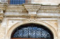 Rethymnon Old Town at 15.4km (NW) The church of Saint Francis is one of the most important monuments of Rethymno. It was the main temple of the Monastery of the Franciscan Order. The architecture of the building - a single aisle Basilica type with wooden roof - and its ornaments are very interesting. Next to the east side of the temple two deserted chapels are preserved. Its Corinthian style main doorway is impressive, with capitals of composite order. During recent excavations around the church valuable archeological findings have been discovered, including two tombs of Venetian nobles. During the Turkish occupation the temple was turned into an "Imaret" (a shelter for the poor). It was also used as a cultural center until 1996. It was recently renovated to accommodate the Byzantine and Post-Byzantine Collection of the Prefecture of Rethymno. 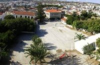 Rethymnon Old Town at 15.4km (NW) The square of Mikrasiaton (GR: Πλατεία Μικρασιατών) formerly the 1st primary school square, in Rethymnon town, covers an area of 7,500 square meters, right at the heart of the city's historical center. It is surrounded by valuable monuments and beautiful buildings, mainly used as cultural centers. There, visitors have the opportunity to rest in a peaceful environment and at the same time visit the various monuments and cultural centers located in the area. Image Library
 Rethymnon Old Town at 15.5km (NW) The Contemporary Art Museum of Crete was founded in 1992 as Municipal Gallery ‘L. Kanakakis'. It is housed in a Venetian building at the old city of Rethymno, below the Fortezza fortress and the Archaeological Museum. It houses a permanent exhibition of the work of Lefteris Kanakakis (oil paintings, sketches and aquarelles), thus representing all the stages of his achievements, as well as works of contemporary Greek artists, which cover a broad spectrum of modern Greek art as it has been accomplished from 1950 until today. Address: 5, Heimaras Str. 741 00 Rethymno Tel: +30 28310 52530 Website :www.rca.gr 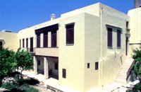 Rethymnon old town at 15.5km (NW) The Historical and Folklore Museum of Rethymno is located next to the Neratze Mosque. It is an institution of public benefit, founded in 1973 by the President of the Historical and Folklore Institution, Christoforos Stavroulakis, and Fali Vogiatzaki. The museum is housed in a restored Venetian building with an interior courtyard. The building is a wonderful piece of urban residence of the last phase of the Venetian occupation of Crete, built in the renaissance style by traditional craftsmen. Image Library
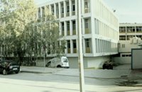 Rethymnon city at 15.5km (NW) Rethymnon General Hospital is situated at 17, Trandalidou Str., close to the municipal gardens. The hospital has all major clinical specialties, outpatient clinics, intensive care unit and generally offers sufficient medical services throughout the prefecture of Rethymnon. 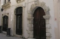 Rethymnon Old Town at 15.5km (NW) The Museum of Submarine Life is situated at Arapatzoglou street, at the center of Rethymno's old city. It was founded by the "Moshaki" family, in memory of their lost child, who drowned in the sea. The largest part of the exhibits are made up of shells, while a few vertebrates, sponges and fish are also on display.
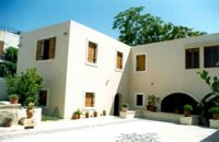 Rethymnon city at 15.6km (NW) The Institute for Mediterranean Studies (IMS) based in Rethymno, Crete, was founded in 1985 and belongs to the research units of the Foundation for Research and Technology, Hellas (FORTH). The IMS is the only FORTH centre which deals with the human and social sciences. The purpose of IMS is to support and invigorate research in the field of the human and social sciences, as well as to promote the application of advanced technologies in the field. The IMS possesses a fully equipped Laboratory of Geophysical-Satellite Remote Sensing (GIS) & Archaeo-environment, specialized in archaeological research. The Library of the Institute is focused on Turkish Studies and Art History. In the Library archival material, as well as collections of Greek and foreign newspapers in digital form and microfilms are kept. The objective of the IMS's research programs is to study the geographical space, the history and culture of Greece and the other Mediterranean countries in various historical periods, from prehistory to modern times. In order to achieve these objectives, the research projects of the Institute are organized along the following axes: Turkish Studies History Studies Art History History of the Theatre - Ethnomusicology The Laboratory of Geophysical-Satellite Remote Sensing & Archaeo-environment Its activities concern the field of geophysical research, the satellite remote sensing, the Geo-information technologies and the archaeo-environment, with emphasis on the Mediterranean region. The Laboratory is a member of international organisations such as EPOCH, EARSel. and AGILE and participates in a number of joint research and technology programs in Greece and abroad (e-Content, INTERREG, ARCHIMED, ETPA, PEWNED, EPEAEK, INSTAP, LIFE, Region of Crete). The research programs of the Institute are carried out by its permanent researchers and collaborating faculty members. In the frame of these research programs are prepared PhD Thesis and other diplomas which are submitted to the higher educational institutions with which IMS collaborates and, particularly, to the University of Crete, the Technical University of Crete and the Technological Educational Institute of Crete. The IMS supports education at post-graduate and post-doctoral level with a considerable number of annual scholarships, thus contributing to attract a steady flow of young researchers and to promote research in the field of humanities at the periphery. The IMS maintains close academic links with various international research foundations (Cyprus, Turkey, Bulgaria, Italy, France, Spain, England, Belgium, Tunesia, Egypt, China, USA, a.o.). The IMS is administered by a director and a five member academic council (A.C.). It is housed in wholly-owned premises comprising of two listed buildings in the old town of Rethymno. The core of one edifice dates back to the Venetian period (13th - 17th century). Links: www.ims.forth.gr/ 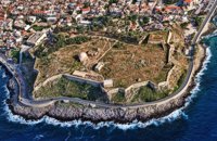 Rethymnon town at 15.8km (NW) The Fortezza castle, at the top of a low hill named "Palaiokastro" dominates the town. It was built in 1590 to protect the city from the pirates raids and the Turks. The name "Palaiokastro which means 'The old Castle' was in use even by the Venetians which demonstrates the existance of an even older castle at this place. - Probably the acropolis of the ancient town of Rithymna. The interior of Fortezza accommodated the following basic buildings: the storeroom of the artillery, where canons and weapons were kept, the residence of the Councilors, where one of the city's two Venetian councilors lived, the residence of the Rector, which represented a luxurious, magnificent building in the central square of the fortress. Today parts of those buildings, as well as of some others built later, can be seen. The view from up there is magnificent, especially at night. The municipal theatre "Erofili" stands also at Fortezza's premises. It is an outdoor theatre that hosts almost all the performances during the Renaissance Festival. Image Library
 by Richard Ellis at 15.9km (SE) This is my log of the E4 long distance walk along the spine of Crete from East to West - it is intended to be a useful resource for others who are contemplating a similar walk along the E4 in Crete; it is not intended in any way to be a complete route guide.
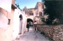
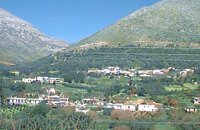 Mylopotamos, Rethymno at 17.8km (E) Apladianá (GR: Απλαδιανά) is a small village built at the foot of the two Kouloukona heights. The settlement stretches out along the old national road, where it developed after the opening of the new national road. It comprises cafes, tavernas, and accommodation facilities included in the Countryside Tourism programs. It is worth your while, however, to visit the old village, climbing there on foot or by car. Picturesque, narrow streets, wonderful old houses with interesting architectural elements, old cisterns and churches will reward your efforts. The old village built on a height of 260 m above sea-level has 175 inhabitants and the settlement along the old national road, known as "Kampos ton Apladianon", has 78 inhabitants. It is 40 kilometres away from Rethymnon and is located at the foot of the highest peak of the Kouloukona mountain in the Tallaios range. Historical background Already as far back as 1368 we find a mention of the Aplada family, the founders of the present village and in the topographical maps of the Civil Engineering Services of Rethymnon it figures as Pladiana. The settlement is not mentioned in the 16th and 17th cent. documents. In the 1881 census, Apladiana is attributed to the commune of Garazo, with 57 inhabitants and in 1900 it is referred to as the Apladiana Commune which, together with the Cheliana settlement, had 153 inhabitants. 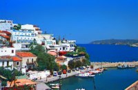 Rethymnon North coast at 18.1km (NE) Bali is a small fishing village, about 40 km west of Iraklion and 37km east of Rethymno easily accessed from the international road. It has a small picturesque harbour and lots of small coves with wonderful clear beaches. Recent years Bali has been developed to a popular tourist resort but it is still preserves its traditional character. Ideal place for family holidays, with small hotels and lovely taverns serving fresh fish and local specialties. 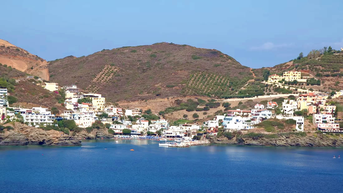 The Venetians called the place "Atali", from its ancient name which was "Astali", while its current name was given by the Ottomans. There is also the Atali Monastery nearby, which retains the medieval name of the place and is dedicated to Saint John. The monastery is built on a small elevated peninsula overlooking the bay and the Cretan sea. Image Library
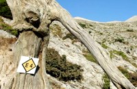
 Gonia, Rethymno at 18.3km (W) The Municipality of Nikiforos Fokas is located in the north of Rethymnon Prefecture. The area is known for its outstanding natural beauty and its historical tradition and architecture. All of the municipality's settlements are steeped in history and contain fine examples of architecture, featuring stone buildings with vaulted entrances (known as "diavatika") and magnificent thresholds. The municipality's jurisdiction extends over the fourteen former community wards of Agios Konstantinos, Ano Valsamonero, Atsipopoulo, Gerani, Gonia (Athanatos), Zouridi, Kalonyktis, Kato Valsamonero, Malaki, Mountros, Prines, Roustika, Saitoures and Frantzeskiana Metochia, which comprise a total of 21 villages. 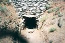 Amari, Rethymnon at 19.7km (SE) The village of Apodoulou is located 55 km from Rethimno at an altitude of 450m. Remains of an extensive centre of the Old Palace period (1950-1700 B.C.) have been uncovered.at the site called Gournes, near the village of Apodoulou, at the west foot of Psiloreitis. The site dominates the Amari valley and controls the main route to the Messara plain. Excavations have brought to light three building complexes while tholos tombs of the Postpalatial period (1380-1200 B.C.) have also been located in the adjacent area. The first excavations on the site were carried out by S. Marinatos in the 1930's. During World War II it was excavated by the German Archaeological Institute, under the direction of E. Kirsten. Since 1985, systematic excavations have been carried out by the Greek Ministry of Culture in collaboration with the University of Naples. The most important monuments on the site are: Building A. It lies on the east side of the hill, to the south of the massive retaining wall. It had two storeys, as is indicated by the two preserved steps of a staircase. Decades of pithoi and other vases found on the ground floor suggest that it was used for storage. The house was destroyed by fire which followed an earthquake. Building B, located to the north of the retaining wall. It is a complex of rooms which originally communicated with Building A. Building C. It lies to the east of house A and belongs to a later phase of the settlement. Tholos tomb at Sopatakia. Tholos tomb with dromos, lying to the east of the road that leads from Apodoulou to Nithavris. The dromos is 7 m. long and the chamber has a diameter of 3.10 m. Three larnakes were found inside the burial chamber. Dated to 1380-1200 B.C. Source: The Hellenic Ministry of Culture 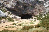 Psiloritis Mountain at 21.4km (SE) At 1538m above sea level, 20 km. south of the traditional town of Anogia , on the plateau of Nida, of Mountain Psiloritis, lies this sacred cave, where according to mythology, Rhea, Zeus' mother, hid the new born Zeus in this cave in order to protect him from his father Kronos (Saturn), who was in the habit of swallowing his children because he feared they might deprive him of his power. Hidden in that cave Zeus grew up being fed with the milk of the goat Amalthia, while the 'Kourites" covered the child's crying through banging their copper shields. Image Library
 by Richard Ellis at 22km (SE) 15th June- The path up to the summit of Psiloritis is well-known and well-marked and does not need any further description from me. Fortunately for me, my pack was lighter by about 4 kg as I had handed over my camping equipment and extra food supplies to T who was going to catch the ferry back from Chania two days later and who could drop my gear at the flat en route. Distance:20.1 km Time: 8 hrs. Mov av 3.2 km/hr Height overnight: 427m. Max. height:2,454 m  Anogia at 22.2km (E) The artistic events, which take place every year in the first week of July at the same place called Fourni and in the Cretan village of Anogia. The poet, songwriter and singer from Anogia, who they call "Loudovikos from Anogia" wants to make the history of the young martyr, who supersedes his fear in love known to the public. And because 1.900 years have passed since the martyrdom of Yakinthos, he decided to honor the Saint of Love and sing together with him of the poetry of love.(www.yakinthia.com)
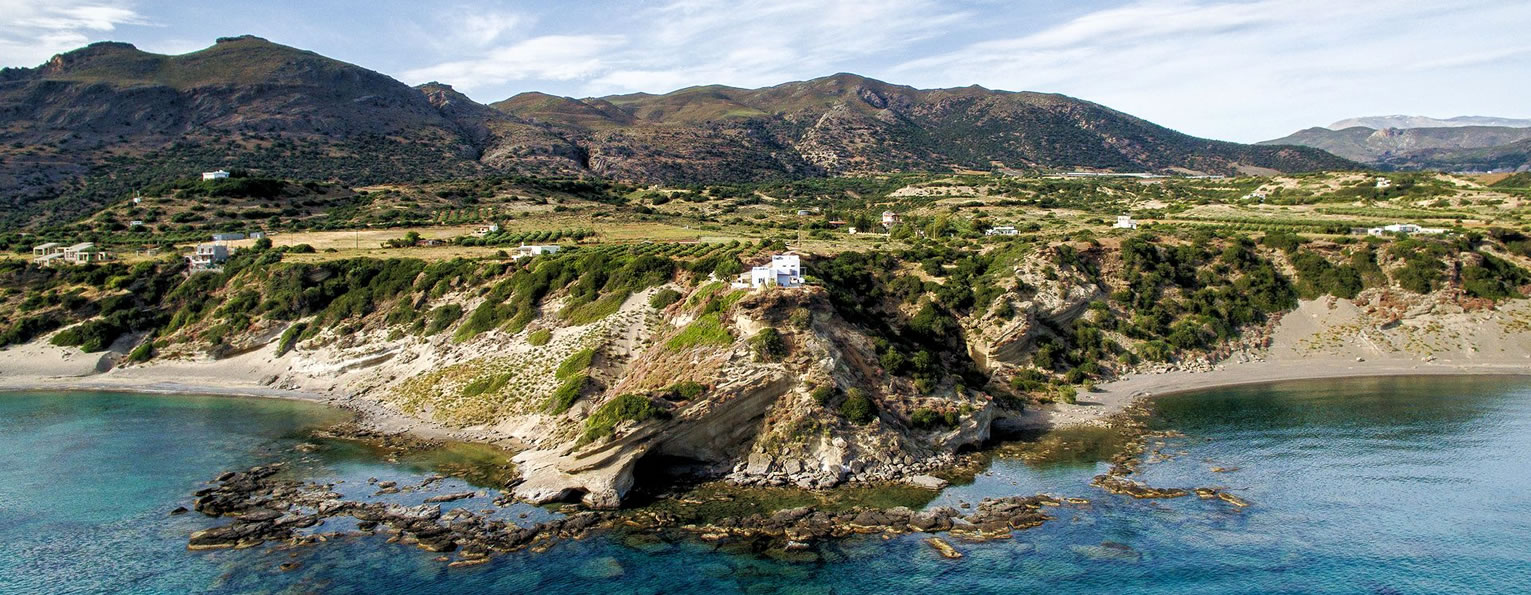
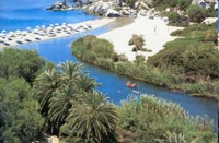 Rethymno (South) at 22.5km (SW) The gorge that forms the river "megapotamos" ends at the Libyan Sea creating a small lagoon at its mouth. This lagoon, which the locals call "Lake" (limni , Gr:Λίμνη), is surrounded by palm trees and rich vegetation and is one of the most attractive places in Crete. In the past it used to be the ideal place for camping and naturalism. The sea is clean with a dazzling range of green and blue colors and the beach has fine white sand. Image Library
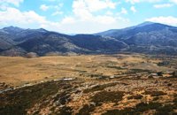 Psiloritis Mountain at 22.6km (SE) The plateau is located in the center of the Ida mountain range at an altitude of 1400 m. It can be accessed from various sides but the only asphalt road is from the town of Anogeia. It has a roughly triangular shape and is almost flat. Visitors can enjoy the wild landscape, take a walk to the entrance of Idaion cave or to the freedom fighter sculpture, made with boulders from the mountain. An other interesting attraction is the various Mitata scattered all over the area. Those are circular domed buildings made with stones and used by shepherds for accommodation and storage of cheese. There is also a tavern with traditional food. The area of Nida, in earlier times, before the systematic farming and logging damage the flora of Psiloritis, was covered by forests in which mythological and traditional tales put different events. Here Dimitra fell in love with the mortal Iasion. http://www.anogialand.gr |
||
|
| ||
C
O
N
T
E
N
T
S
O
N
T
E
N
T
S