interkriti®
YOUR GATEWAY TO CRETE
|
Crete
: Regional Interest
List Grid Map
Found
284
- Showing :
41 - 60
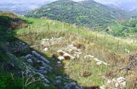 Kasteli, Pediados The ancient city of Lyktos or Lyttos (GR: Λύκτος / Λύττος) was one of the most ancient and powerful towns in Crete. Although the excavations in the area reveal traces of habitation from the Hellenistic years onwards (630 B.C.), the archeologists Georgios Rethemiotakis and Angeliki Lempesi have excavated traces of habitation from the time of the destruction of Lyttos by the Knossians (219 B.C.) in excavated residences of the Hellenistic period. From the Roman period, the city was subject to new workings as testified by the architectural remnants and the many inscriptions and statues discovered. Numerous vestiges of ancient structures, objects, and broken marbles are seen, as well as an immense arch of a Roman aqueduct, by which the water was carried across a deep valley by means of a wide marble channel. Traces of the aqueduct which brought its water supply from Kournia, near Krasi village, are still visible today in the rural road to Kastamonitsa village. Lyktos had also a theatre, built in the slope of the hill the design of which we know only from the drawings of Belli (1586). Finally, the most important discovery is that of a room of nearly 14 metres by 11.40 metres, with marble flooring and a series of four stone platforms along its two longer sides. The room was erected, according to the inscription that was found at the site, at the beginning of the second century B.C. This room was identified as the chamber of the Roman deputies of the city and was very probably destroyed by an earthquake at 365 AD. Lyktos appears to have still been inhabited in the 7th Century AD as indicated by the excavation of late-roman shops in the area. (Late Roman Empire, 284-610 AD) 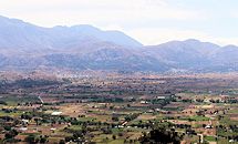 Lassithi, Dikti Mountains The Lassithi Plateau (GR: Οροπέδιο Λασιθίου, Oropedio Lasithiou), is a high endorheic plateau, located in eastern Crete, Greece on the mountain range of Dikti at an average altitude of 840 m, and in a distance of around 55km from Heraklion and 50km from Agios Nikolaos. The plateau is elliptical in shape with an E-W axis of 11km and the N-S of 7km. The plateau of Lassithi is renowned for its exceptional agricultural produce, the thousands (almost 15000) windmills that used to be there in the past, its significant historical role and for the unique cave of Psychro also known as "Diktaion Andron". Image Library
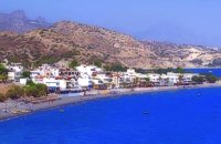 Ierapetra, Lassithi Myrtos (GR: Μύρτος) is situated 15km to the west of Ierapetra, at the estuaries of the river Sarantapihos, in a valley with olive and orange trees. It is a beautiful village built by the sea, with a beach street lined with taverns and cafe bars. In a short distance from Myrtos on a low hill lies the archaeological site of "Pyrgos" with the ruins of a villa from the post minoan period and a little further at "Fournou Koryfi" lie the ruins of a proto minoan settlement. Myrtos features a small archaeological museum with exhibits mostly from the area, an initiative of a local teacher. Myrtos is a popular tourist destination, with nice small hotels, picturesque taverns and kafeneions, a lovely sandy beach and hospitable people. Image Library
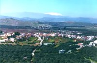 Pediada, Iraklion Kastelli (GR: Καστέλλι) is a small town in the countryside of the province of Pediada. It has over 2000 inhabitants and provides all the modern facilities and public services its residents and/or visitors may need. Many events are organized through the year by the municipality, the school and the cultural centre. In August a special festival, known as the Feast of Xenitemenou (ex-patriot feast) includes concerts, folklore, exhibitions and theatre plays.
 Kenouriou, South Iraklion Zaros (Greek: Ζαρός), at an altitude of 340 metres, is a town with a lake and gorge nearby. It has a couple of hotels and it is 44 km from Heraklion at the southern foothills of Mountain Psiloritis. The population of 3,400, produce olive oil, sultanas, vegetables and spring water. There are a couple of fish farms that serve both trout and salmon. In Zaros, there are cafes near Lake Votomos, as well as a tavern that serves fresh trout called I Limni (The Lake). Close by is Rouvas Gorge, which is part of the Psiloritis mountain range and is on the hiking route known as the E4 European Walking Path. Nearby Zaros are traditional water mills which have been working since the 16th century, as well as archaeological sites and monasteries. Zaros is also famous for its water "ZAROS" bottled by a company called Votomos SA. 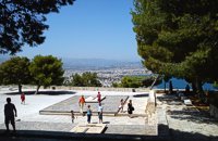 Akrotiri, Chania At the magical and historical location of Profitis Ilias, in Akrotiri, at the east of Hania lays the tomb of Eleftherios Venizelos, one of the most long-standing prime ministers of Greece and whose political life was focused on doubling the size of Greek territory and on the creation of a contemporary State. Eleftherios Venizelos himself had designated this position to be his resting place before his death. For the visitor, it affords a panoramic view of the rich green plain of Hania, the imposing White Mountains, the Cretan Sea, the town of Hania and the Chalepa quarter which is the location of the house in which the great politician spent most of his life and today is the headquarters of the National Research Foundation 'Eleftherios K. Venizelos'. Image Library
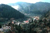 Chania Thérisso (GR: Θέρισο) is a small village, built on the foot of the White mountains, at 580 m a.s.l, 20km south of the city of Hania. It has 156 inhabitants and it is famous for its physical beauty, its diary-farming and its glorious past. You can reach Therisso from Perivolia passing through the Canyon (good asphalt road), or from Drakona, crossing the 7km dirt road through the forest. From here starts the trekking path which leads to the highest peak of the White mountains, Pahnes (2452m) Due to its location Therisso played a significant role at the history of the island especially during the 19th Century. A mill's stone located at the entrance of the village reminds the death of a young woman (grinded alive), when she denied to surrender to Mustafa Pasha. Here were born the great Cretan revolutionaries (Hainis), Vassilis, Giannis and Stefanos Halis. Vassilis Halis, became a hainis very young, and participated to the most great battles against the Turks in Crete and Peloponnissos. He was lt General when he died at Nafplion (Peloponnissos) in 1846. But Therisso is mostly known for its relation with the Venizelos movement in March 1905. Venizelos, who dissented with prince George' policy and declared the Union of Crete with Greece, had his headquarters at Therisso. The house of Venizelos is today a museum. The visitor to Therisso will admire the natural beauty, learn a lot of the history of the place listening to various stories and looking at the historical monuments, and taste the local specialties at the lovely taverns of the village. 2,5 km north of Therisso, at the left bank of Kladissos river, there is a cave where signs of neolithic and Minoan habitation were discovered. It is believed that it was a worship place. 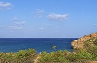 Sitia, East Lassithi A palm tree forest stretching on a marvelous valley and sandy beach. It consists of self planted palm trees of Theophrastus (Phoenix Theophrasti). It is unique of its kind in Greece, Europe and probably the world. Vai because of its special value and beauty is protected by the Greek state, European Union and international contracts. The protected area covers 23.4 ha. The sandy beach of Vai is amongst the most beautiful in Crete and Greece and attracts thousands of visitors every year since Vai is a top destinations especially for the new comers. The small islets opposite the beach add a lot to the beauty of the place. There is a parking area, a tavern, a canteen, umbrellas and seabeds. There is regular public bus connection with the towns of Sitia and Palaikastro during the summer and many organised day trips by travel agencies. If you don't like crowds, you can walk a little to the south from Vai to Psili Ammos a lovely small beach with fine gold sand which is nested in a small cove. Image Library
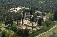 Messara, Iraklion South Located in the valley of Messara, Gortys or Gortyn (GR: Γόρτυς or Γόρτυνα) is a must visit for all visitors to Crete. It was inhabited during Bronze Age times, but its rise to glory came almost a millennium after the downfall of the 'Minoans'. Gortyn was a prosperous city from around the middle of the 5th century BC through to the early 9th century AD, when it was finally destroyed by the Saracens (824AD), never to be rebuilt.
Image Library
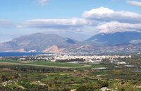 Messara, Iraklion South The town of Timpaki (GR: Τυμπάκι) is located in the west edge of the plain of Messara, 65.3km away from the city of Iraklion. It is a rich and busy town with significant economic activity especially due to the early vegetables production in the wider area. There are banks, a post office, medical centers, stores, schools, hotels, restaurants, ect to cover both the needs of the locals and visitors.
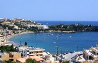 Malevizi, North - West Iraklion Agia Pelagia lies 20km west of Iraklion. The bay of Agia Pelagia is ideal for combining sea sports with relaxation. The visitor will find well trained instructors that offer lessons for sea sports such as water-ski, wind surf, canoe. Agia Pelagia offers unique high standard hotel facilities as well as many small hotels and pensions.
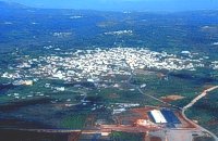 Central Iraklion The town of Arkalochori (GR: Αρκαλοχώρι) with a population of 2.881 is located 33km away from Heraklion, on the provincial road linking Heraklion and Viannos, at 395m above sea level. Its inhabitants are mostly involved in agriculture, but in commerce and arts as well. Arkalochori is one of the most developing towns in the prefecture of Iraklion both in economic and cultural sectors and is the administrative center of the area. Events such as the Pancretan Agricultural and Commercial Exhibition, that takes place here are of great significance and interest for the whole island. The town offers a full range of modern facilities to its residents and visitors.
Image Library
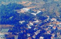 Apokoronas, Hania Vámos (GR: Βάμος) is the capital of Apokoronas district is an exceptionally interesting village that the Ministry for the Environment, Physical Planning and Public Works has classed as traditional. It is more like a small town, very well preserved, with folk and neoclassical architectural elements. The initiative of a group of inhabitants to create an association for the preservation of the village as well as alternative tourism strategies is already paying off while constituting a model for further local progress. The famous art and cultural festivals are good opportunities for everyone to experience the hospitality and entertainment Vamos can offer.
 Kenourgiou, Iraklion Agia Varvára (GR: Αγία Βαρβάρα) is a town built along the road between the Messara plain and the Malevizi region at the highest point (580 m). The town enjoys a unique location with a splendid view into the Malevizi region, and a cool climate, particularly pleasant during the hot summer months. It produces first-rate fruit and vegetables. Because of its strategic location on the main north-south axis, the town was often exposed to fierce battles. A famous warrior, Mathiou Kapitakis or Mathioudakis was born here: he fought side to side with Karaiskakis and was killed at Faliro. His comrade-in-arms, Logios, was the hero of Aghios Thomas. As you reach the village, on the north side there is a rock with a chapel dedicated to Profitis Ilias. On this rock -which used to be twice as large but part of it fell off at the beginning of the 19th century- there used to be an ancient temple. Nowadays, the visitor can find every kind of commodity and facility on hand at the modern town of Aghia Varvara. In summer a special 'tsikoudia' feast, and in early spring a carnival feast are organized by the Cultural Association of the town. At the centre of the town, there are two churches - one old and one new - both dedicated to the patron saint, Aghia Varvara. Three Byzantine churches are also well worth a visit: Profitis Ilias, Aghios Giorgos and Aghios Ioannis, and of course the old monastery of Aghia Pelagia by the cemetery.  Agios Vassilios, Rethymnon south It stands 37 km south of Rethimnon, in an imposing landscape which is mentioned at the mid-19th century diary of Th. Spratt (admiral of the British Royal Navy), as "one of the happiest places to withdraw from trials and responsibilities of life".There are lots of legends concerning the foundation of the monastery, which is believed that started during the Venetian occupation of the island. A number of its monks activities made the monastery one of the richest of western Crete and due to its isolated position it played important role in Cretan revolts against the occupying forces. A substantial number of icons and other items is kept in the Museum of the Monastery of Preveli amongst them the miracle - working Eulogistic Cross of Efraim Prevelis.
Image Library
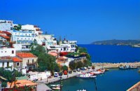 Rethymnon North coast Bali is a small fishing village, about 40 km west of Iraklion and 37km east of Rethymno easily accessed from the international road. It has a small picturesque harbour and lots of small coves with wonderful clear beaches. Recent years Bali has been developed to a popular tourist resort but it is still preserves its traditional character. Ideal place for family holidays, with small hotels and lovely taverns serving fresh fish and local specialties. 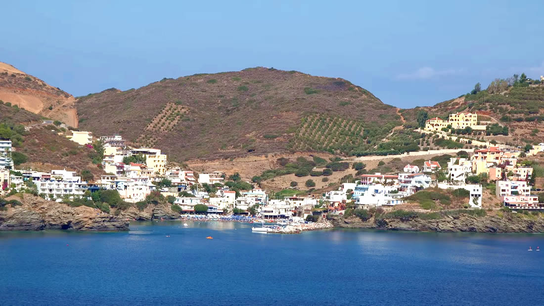 The Venetians called the place "Atali", from its ancient name which was "Astali", while its current name was given by the Ottomans. There is also the Atali Monastery nearby, which retains the medieval name of the place and is dedicated to Saint John. The monastery is built on a small elevated peninsula overlooking the bay and the Cretan sea. Image Library
 Iraklion Ammoudara (GR: Αμμουδάρα) is four kilometre long sandy beach that stretches from the west end of Heraklion to Linoperamata near the village of Gazi. The sand is fine and blond and extends several metres to the land and the sea is clear and safe. The predominant winds during the summertime are N, N-W usually "meltemi" that get more fresh at the western end of the beach, where the windsurf school is located. Along the shore there are hotels, some of them very large complexes, taverns, restaurants, bars, cafes etc that offer umbrellas and sun-beds on the beach. There are also lifeguards in some spots. The area in general is touristic and offers a full range of facilities, among them the modern multiplex "Technopolis" with cinema and an open-air theater. Image Library
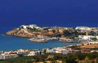 Sitia south Makry Gialos (Long shore GR:Μακρύ Γιαλός) is a small beach resort on the south-east coast of Crete, located 60km from Agios Nikolaos, 25km from Ierapetra, and 33 km from Sitia. Makry Gialos features a small fishing harbour and a nice 1km long sandy beach that stretches from the harbour to the east. Four more lovely beaches can be found in the immediate area. Accommodation is available mostly in family-run studio and apartment complexes and there is a good choice of bars, restaurants, tavernas, some of them right on the beach front or at the small fishing harbour. Makry Gialos is the administrative centre of the wider area which comprises some picturesque traditional villages built on the tree covered mountain sides. The area has been inhabited since the Minoan times as many ruins from this as well as the Roman and the Venetian periods prove. 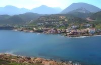 Sitia, East Lassithi A small picturesque village by the sea characterized as a landscape of exquisite, natural beauty. With joyful and peaceful inhabitants who constantly tease each other. It is located in Crete, north of Lasithi prefecture, between Agios Nikolaos and Sitia, at equal distance (30-35km) from the three major cities(Agios Nikolaos, Sitia, Ierapetra). Ideal place for holiday or special weekends. You will enjoy the most colourful sunset and the most beautiful daybreak from any other place. The serenity of the morning open view, with the sun rising from the sea, will be unforgettable. The small island, opposite the village, with the small church of Agios Nikolaos, offers a unique beauty to the landscape. 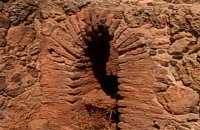 Sitia south In Makry Gialos, at the place Katovigli, near the church of the Dormition of the Virgin, have been unearthed remains of a Roman Villa. Pendlebury (BSA XXXIII p. 100) had already noted the existence of a Roman settlement here. Excavations begun in 1977 (not yet completed), have shown that there were indeed large domestic establishments, dated from the 1st century BC to the 3rd century AD, but it is not possible at this stage of the excavations to draw definite conclusions. One room after another has been discovered and the whole excavation so far, covers an area of roughly 1500 sq.m. |
||
|
| ||
C
O
N
T
E
N
T
S
O
N
T
E
N
T
S

